TL;DR
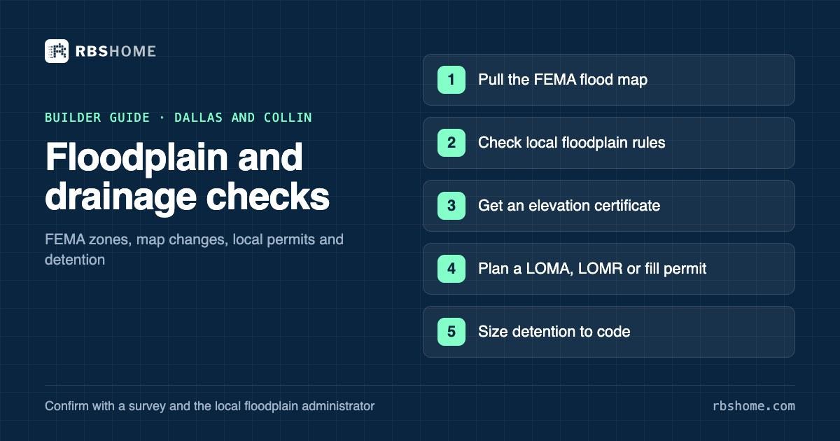
Start every lot with FEMA's Flood Map Service Center: Zones A and AE are the Special Flood Hazard Area, the land expected to flood in a 1-percent-annual-chance event, while Zone X is outside it. In Dallas, a new structure in the floodplain needs a fill permit and City Council approval. In unincorporated Collin County, new residential construction isn't allowed in the flood hazard area, and homes next to it must sit at least two feet above the base flood elevation. Even outside the floodplain, cities such as Dallas require detention when development increases runoff, with an exemption for small infill sites.
In this article
- 1. Why floodplain is a lot-level question here
- 2. Reading a FEMA flood map: FIRMs and zones A, AE and X
- 3. Elevation certificates
- 4. LOMA, LOMR-F, CLOMR and LOMR: changing the map
- 5. City of Dallas floodplain rules
- 6. Unincorporated Collin County rules
- 7. The Trinity River corridor and Lavon Lake
- 8. Drainage and detention outside the floodplain
- 9. A floodplain and drainage checklist for any lot
A lot that looks dry on a sunny day can be unbuildable on paper. In Dallas and Collin County, creeks run through established neighborhoods and new subdivisions alike, and the line between a buildable lot and a lot that needs a year of engineering can cut across a single parcel. Floodplain status also follows the house after you sell it, because lenders can require flood insurance on homes in mapped flood hazard areas.
This guide covers the checks we run on every lot: the FEMA map, elevation certificates, map changes, the City of Dallas and Collin County rules, two local features that catch buyers out, and drainage and detention for lots outside the floodplain.
Why floodplain is a lot-level question here
Three things make floodplain a parcel-by-parcel question in North Texas.
- Creeks are everywhere. Dallas and the growing Collin County cities are laced with small creeks and drainage channels, so mapped floodplain often clips the back of a lot rather than covering a whole neighborhood.
- Local rules go beyond FEMA. Cities and counties adopt their own floodplain regulations. The City of Dallas, for example, requires City Council approval for new structures in the floodplain. Collin County bars new residential construction in the flood hazard area in its jurisdiction.
- Maps change. The FEMA Flood Map Service Center warns that the flood information you download may later be superseded by new maps. Collin County adopted updated floodplain management regulations on November 4, 2024, citing FEMA map updates.
The cost of getting it wrong is high. A floodplain problem found after closing can mean months of engineering, a fill permit, a map revision, or a lot you can't build on at all.
Reading a FEMA flood map: FIRMs and zones A, AE and X
FEMA publishes Flood Insurance Rate Maps (FIRMs) through its Flood Map Service Center, which describes itself as the official public source for flood hazard information produced for the National Flood Insurance Program. You can search by address, place or coordinates and view or download the map panel for your lot.
The zones that matter most, using FEMA's flood zone definitions:
| Zone | What it means | What it means for a builder |
|---|---|---|
| A | Special Flood Hazard Area: expected to flood in the 1-percent-annual-chance (100-year) flood | Usually no base flood elevation on the map, so an engineer may need to establish one |
| AE | Special Flood Hazard Area, with base flood elevations shown | Local rules key your floor height and fill limits to the base flood elevation |
| X (shaded) | Moderate flood hazard, between the 100-year and 500-year flood limits | Outside the Special Flood Hazard Area, but not risk-free |
| X (unshaded) | Minimal flood hazard, above the 500-year flood level | Generally no floodplain permit, but local drainage rules still apply |
A few tips for reading the map:
- Find the regulatory floodway. Where one is mapped, the floodway is the channel and nearby land reserved to carry floodwater. Local rules are strictest there.
- Check the panel date and any letters of map change. A newer map revision or amendment may already have changed the zone on your lot.
- Don't stop at FEMA. The City of Dallas floodplain page says Dallas uses the 1-percent-annual-chance flood as its design standard, and suggests three ways to estimate whether a property is in it. They are the FEMA flood map tools, the City's zoning GIS site, and the "FEMA NFHL Flood Zones" layer on the Dallas Central Appraisal District map. Those are screening tools. A survey settles it.
Elevation certificates
An elevation certificate records a building's or site's elevations relative to the base flood elevation. FEMA describes it as an administrative tool of the National Flood Insurance Program used to show compliance with local floodplain ordinances, set insurance premiums and support requests to change the map.
FEMA's guidance says the certificate must be prepared and certified by a licensed land surveyor, registered professional engineer or registered architect who is authorized by state or local law to certify elevation information. It also says using the certificate doesn't waive the flood insurance purchase requirement on its own.
When you need one:
- Buying a lot near a mapped zone. A surveyor's elevations tell you whether the buildable part of the lot sits above the base flood elevation.
- Building near a flood hazard area. Collin County's floodplain regulations require an engineer or surveyor to submit proposed lowest floor elevations with the permit or plat application for residential construction adjacent to a flood hazard area.
- Asking FEMA to change the map. A LOMA or LOMR-F request needs elevation data.
- Selling the finished house. Buyers and their insurers will ask for one if the property is near a mapped zone.
LOMA, LOMR-F, CLOMR and LOMR: changing the map
FEMA's maps work at a scale that can't capture every lot's grade. If your lot is mapped in a flood hazard area but sits above the base flood elevation, or will once it's filled, there's a process to fix the map. FEMA's map change page and its LOMR and CLOMR guidance describe four tools.
- Letter of Map Amendment (LOMA). FEMA's determination that an existing structure or parcel isn't in the base flood's path because it's on naturally high ground that hasn't been raised by fill.
- Letter of Map Revision Based on Fill (LOMR-F). The same kind of determination for a structure or parcel that has been raised by earthen fill.
- Conditional Letter of Map Revision (CLOMR). FEMA's advance comment on whether a proposed project would meet program standards if built as designed. It doesn't change the map, and it doesn't replace a local floodplain permit.
- Letter of Map Revision (LOMR). A formal revision to the effective map based on physical changes, such as fill, channel work or new culverts. It changes the map without reprinting the whole panel.
Homeowners and others can file LOMA and LOMR-F requests online. Licensed surveyors and engineers can use FEMA's eLOMA tool, which FEMA says can return a determination within minutes for qualifying cases.
A LOMA is about the map. A permit is about the work.
FEMA letters change what the flood map says. They don't authorize filling or building. In Dallas and Collin County, the local floodplain permit is a separate approval, and Collin County requires a LOMA or LOMR before residential construction in a flood hazard area.
City of Dallas floodplain rules
The City of Dallas regulates floodplain development under Section 51A-5.100 of the Dallas Development Code, as its Floodplain and Drainage Management page explains. The key points from that page:
- Two permit types. A floodplain alteration permit covers work such as retaining walls, pools and fences in the Special Flood Hazard Area, plus improvements that don't remove the floodplain designation, like decks or playgrounds. A floodplain fill permit is required to reclaim floodplain land for development.
- New structures need City Council approval. A new structure requires a floodplain fill permit and final approval by the Dallas City Council.
- Substantial improvements are restricted. They aren't permitted unless the Board of Adjustment grants a special exception based on hardship.
- No adverse impact. The regulations aim to make sure projects can be finished with no adverse impact on other properties.
- Demolition is simpler. Demolition in the 100-year floodplain doesn't need a separate floodplain permit, though it may need building permits.
The page lists a Floodplain Management phone line for questions. For a builder, the practical rule is that a Dallas lot with the house pad in the mapped floodplain is a project, not a lot. If only the back of the lot is mapped, design the house and grading to stay out of it, and confirm with the City before you close.
Dallas also regulates an escarpment zone. The City's preliminary plat checklist calls for a copy of the escarpment permit for plats within the escarpment area or a geologically similar area. Property in or draining through the escarpment zone also triggers detention under the plat regulations.
Unincorporated Collin County rules
Outside city limits, Collin County's floodplain management regulations (approved November 4, 2024) govern. They're stricter than many builders expect.
- No new homes in the flood hazard area. New residential construction isn't allowed in a Special Flood Hazard Area. A LOMA or LOMR is required to show that any residential construction proposed in a mapped area will be out of it once construction is done.
- Two feet of freeboard next to it. The lowest floor of new residential construction adjacent to a flood hazard area must be at least two feet above the base flood elevation. The regulations define "adjacent" as the land between the mapped area and the contour two feet above the base flood elevation in Zone AE, or the contour that follows the mapped area in Zone A.
- Elevations up front. For residential construction in or next to a flood hazard area, an engineer or surveyor must submit proposed lowest floor elevations with the permit or plat application. In the flood hazard area, an elevation certification is also due when the lowest floor slab is built.
- Flood studies. Nonresidential construction in a flood hazard area needs a flood study, and no rise in the base flood elevation outside the property is allowed.
The county's Development Services FAQ says unincorporated and ETJ properties are always within the county's permitting jurisdiction, and new construction needs a development permit through the county's online portal. Inside cities, the city's own floodplain ordinance governs, so check with the city's engineering department.
The Trinity River corridor and Lavon Lake
Two local features deserve their own check.
The Trinity River levees in Dallas. A City of Dallas Stormwater Operations flood control brochure says the City took over operation and maintenance of the Trinity River levee system within city limits in 1968. It runs the system under the regulatory control of the U.S. Army Corps of Engineers. The brochure lists about 30 miles of levees, with an average height of 28 feet, along with pump stations and pressure sewers. It says the system protects about 10,000 acres of residential, commercial and industrial property. Land behind the levees depends on that system and its pumps to drain. If you're looking at lots in the areas the levees protect, ask the City how the property drains during high water and whether any local drainage restrictions apply.
Lavon Lake flowage easements. Lavon Lake in eastern Collin County is a Corps of Engineers reservoir, and the Corps holds flowage easements on private land around it. Its Lavon real estate page says the government bought the perpetual right to flood that land up to elevation 509 feet above sea level. The Corps' Know Your Boundaries at Lavon Lake guide adds the details that matter for builders.
- Where they are. Flowage easement lands are generally private lands below the 509-foot contour, but the deed that created the easement controls its exact location.
- What's prohibited. Building or keeping any structure for human habitation or commercial buildings, permanent or temporary, and placing fill, raising the land above the contour or moving the contour line.
- What needs permission. Other structures, including fences, ditches, wells, roads and utility lines, need the District Engineer's written approval.
- Deeds can be silent. The guide warns that the easement restriction is sometimes left out when new deeds are drafted, and that the omission doesn't affect its validity.
The Lavon area is busy: in the 12 months to November 7, 2026, builders recorded 774 purchases in 75166 (Lavon), from 31 different builders. If you're buying near the lake, have your title company look for a flowage easement in the chain of title and your surveyor locate the 509-foot contour.
Drainage and detention outside the floodplain
A lot can be in Zone X and still trigger drainage requirements. Cities require new development not to push more stormwater onto neighbors.
City of Dallas. The City's 2019 Drainage Design Manual, adopted by the City Council on September 11, 2019, applies to private development. Its FAQ says detention is required for any project that increases peak flow or velocity from pre- to post-development conditions, designed for the 1%, 2%, 10% and 50% annual chance storms. The plat regulations (Section 51A-8.611(c)(1)) add four specific triggers:
- The property is in or drains through the escarpment zone or a geologically similar area.
- A rezoning to higher density increases runoff, with exemptions for small changes.
- The development lacks an adequate outfall for the 1-percent storm, or downstream owners won't grant easements. This trigger falls away if the owner funds and builds adequate storm drainage.
- The property drains into a neighboring city that has detention requirements under a written agreement.
The manual exempts infill developments and redevelopments from detention if the parcel is under one acre and adds less than 5,000 square feet of impervious surface compared with existing conditions. A single-family teardown on a typical lot often fits that exemption. A small assemblage of several lots may not. The manual also says all detention requires an easement.
Collin County cities. The North Central Texas Council of Governments publishes regional integrated Stormwater Management (iSWM) criteria that cities can adopt, but each city sets its own rules. Ask the city's engineering department for its current drainage criteria before you lay out a subdivision.
Lot grading. Even on a single lot, plan positive drainage away from the house and make sure you aren't sending water onto the neighbor.
A floodplain and drainage checklist for any lot
Run this before you sign, or during your feasibility period.
- Pull the FEMA map panel for the lot from the Flood Map Service Center. Note the zone, the base flood elevation if shown, and any floodway.
- Search for letters of map change that apply to the lot or nearby properties.
- Check the local map. In Dallas, look at the City's zoning GIS and the DCAD flood layer. In Collin County, check the county's maps and the city's.
- Walk the lot after rain if you can. Look for standing water, erosion, drainage ditches and signs of fill.
- Order a topographic survey with spot elevations. If any part of the lot is near a mapped zone, get an elevation certificate or the surveyor's elevations relative to the base flood elevation.
- Check for easements in the title commitment: drainage easements, floodway easements and, near Lavon Lake, Corps flowage easements.
- Estimate drainage requirements. Will the project add more than the exemption threshold of impervious surface? Is there an adequate outfall?
- Talk to the floodplain administrator before you close if any part of the lot is mapped. In Dallas, ask whether your plan needs a fill or alteration permit. In unincorporated Collin County, ask about the two-foot freeboard rule and a LOMA or LOMR.
- Price the insurance. If the house will be in or near a mapped zone, get a flood insurance quote so you know what your buyer will pay.
RBSHome's builder tools show builder demand and land values by ZIP for Dallas and Collin County, which helps you decide where to look. The floodplain answer for a specific lot still comes from the FEMA map, a survey and the floodplain administrator. You can see builder activity and lot values by ZIP on the Dallas County and Collin County pages. For zoning detail on north Dallas infill, see our zoning and setbacks guide.
This article is general information, not legal or tax advice. For your situation, talk to a Texas attorney, CPA or your title company.
Builder demand and land values by ZIP for Dallas and Collin County.